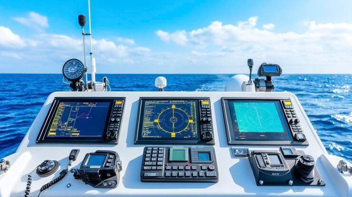
Marine Navigation Equipment Basics With Radar, Sonar, GPS, and Chartplotter Insights
Marine navigation equipment helps vessels determine their position, understand surrounding conditions, identify potential hazards, and follow planned routes across rivers, coastal waters, and oceans.
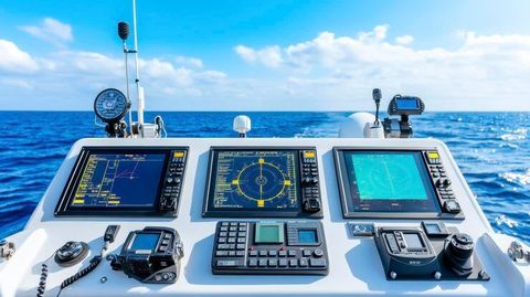
Modern marine navigation equipment commonly includes radar, sonar, Global Positioning System (GPS) receivers, chartplotters, electronic compasses, depth sounders, and automatic identification systems.
These technologies developed from traditional navigation methods that relied on maps, compasses, celestial observations, landmarks, and manual measurements. As electronic systems became more widely available, navigators gained additional ways to monitor vessel movement, estimate distances, identify nearby objects, and interpret underwater conditions.
Each device performs a different function. GPS provides geographical position, radar detects objects using radio waves, sonar uses sound waves to examine underwater surroundings, and a chartplotter displays navigational information on an electronic chart. Understanding these differences helps explain how modern vessels manage navigation in changing environments.
Main Types of Marine Navigation Equipment
Marine navigation systems combine information from several instruments to provide a broader picture of the vessel's surroundings.
Radar identifies objects and their approximate distance and direction.
Sonar detects underwater features, fish, or changes in water depth, depending on the equipment.
GPS determines the vessel's position using signals from navigation satellites.
Chartplotters display the vessel's position, planned route, and electronic chart information.
Electronic compasses indicate heading, while depth sounders measure the water beneath the vessel.
Automatic Identification System (AIS) equipment exchanges identification and movement information with suitably equipped vessels and shore stations.
These instruments can operate independently or share data through an integrated navigation system. Their usefulness depends on equipment configuration, installation quality, environmental conditions, and the operator's understanding of the displayed information.
Importance
Why Marine Navigation Equipment Matters
Marine navigation equipment helps reduce uncertainty when a vessel travels through unfamiliar or busy waters. Navigators must account for shallow areas, changing weather, currents, other vessels, restricted zones, and obstacles that may not be visible from the bridge or cockpit.
Electronic navigation tools can make it easier to monitor these conditions, but they do not remove the need for observation and judgment. Incorrect settings, outdated charts, signal interruptions, equipment failures, or misunderstood displays can contribute to navigational errors.
The equipment is relevant to several groups, including recreational boat operators, commercial shipping crews, fishing vessels, passenger craft, offshore operators, and maritime training institutions. Each group uses different combinations of equipment according to vessel size, operating environment, and applicable requirements.
Comparing Radar, Sonar, GPS, and Chartplotters
The following table summarizes their primary functions and limitations.
Equipment | Main function | Typical limitation |
|---|---|---|
Radar | Detects surrounding objects using radio waves | Small or poorly reflecting objects may be difficult to detect |
Sonar | Examines underwater conditions using sound | Performance depends on depth, water conditions, and equipment type |
GPS | Determines geographical position | Satellite signals can be obstructed or disrupted |
Chartplotter | Displays position and routes on electronic charts | Accuracy depends partly on chart quality and input data |
Depth sounder | Measures water depth beneath the transducer | Does not describe the entire underwater area |
AIS | Exchanges vessel identification and movement data | Not every vessel or hazard transmits AIS information |
How Navigation Systems Work Together
A vessel approaching a coastal harbor might use GPS to determine its position, a chartplotter to follow a planned route, radar to monitor nearby vessels and land features, and a depth sounder to check water depth.
AIS can provide additional information about equipped vessels, while an electronic compass helps the operator monitor heading. Comparing these independent sources can reveal inconsistencies that might otherwise go unnoticed.
However, equipment integration does not automatically make every displayed measurement correct. Navigators need to understand what each instrument measures, how its information is updated, and which conditions could affect its performance.
Recent Updates
Digital Navigation and Electronic Charts
Marine navigation equipment is increasingly designed to exchange information between connected devices. Integrated displays can combine position, heading, depth, radar returns, and AIS information, allowing navigators to review several sources from a central screen.
Another important development is the International Hydrographic Organization's S-100 framework for digital nautical information. Operational standards adopted in 2025 and subsequent standards development during 2026 support more detailed and interoperable electronic navigation products. These developments are intended to support richer information layers, although practical availability depends on chart producers, equipment compatibility, and implementation.
Positioning Reliability and Navigation Software
GPS remains a central positioning technology, but maritime operators are paying greater attention to interference, signal loss, and misleading satellite-navigation information. A vessel's displayed position should therefore be considered alongside radar observations, depth information, visual landmarks, and other available navigation references.
Navigation software is also becoming more interconnected. This creates a need for controlled software updates, compatible equipment, appropriate cybersecurity practices, and clear procedures for responding to display failures or inconsistent readings.
Changes in Maritime Communication
International maritime discussions during 2025 and 2026 advanced digital communication and navigation developments. One notable change was the adoption of an international framework allowing a VHF Data Exchange System (VDES) as an alternative to AIS for applicable ships, with the relevant provisions scheduled to enter into force in 2028.
VDES supports digital information exchange between vessels and shore infrastructure. Its implementation will depend on applicable requirements, equipment readiness, and the arrangements adopted by individual operators.
Laws or Policies
International Maritime Navigation Requirements
Marine navigation equipment requirements vary according to vessel type, size, operating area, voyage category, and flag state. The International Convention for the Safety of Life at Sea (SOLAS), administered by the International Maritime Organization (IMO), establishes important international requirements for navigation equipment carried by qualifying ships.
Depending on the vessel and applicable rules, requirements may cover radar, electronic chart systems, AIS, position-fixing equipment, compasses, and other navigational instruments. Smaller recreational vessels may follow different national or regional requirements.
Electronic Charts and Navigation Systems
Electronic Chart Display and Information Systems (ECDIS) are used on qualifying commercial ships to display official electronic navigational charts and support route monitoring. Where ECDIS is used to meet applicable chart-carriage requirements, equipment approval, chart currency, and suitable backup arrangements are important considerations.
A recreational chartplotter is not automatically equivalent to an approved ECDIS. Operators should understand whether their equipment meets the requirements applicable to their vessel and voyage.
Equipment Maintenance and Safe Operation
Navigation equipment needs appropriate installation, testing, maintenance, and operator training. Sensors may provide incorrect readings if they are damaged, poorly calibrated, obstructed, or configured incorrectly.
Important operational practices include:
Keeping electronic charts and relevant publications updated.
Checking GPS position against independent navigation information.
Testing radar, depth sounders, and alarms as appropriate.
Maintaining suitable backup navigation arrangements.
Following applicable radio, AIS, and equipment operating requirements.
Recording and responding to equipment faults.
These practices support safe navigation but do not replace the training, watchkeeping, and operational duties required by applicable maritime rules.
Tools and Resources
Navigation Charts and Planning Tools
Electronic nautical charts provide information about coastlines, water depths, navigational marks, hazards, and designated routes. Depending on the chart and system, additional information may include traffic separation schemes, restricted areas, and harbor details.
Route-planning tools help operators mark departure points, destinations, waypoints, and potential hazards. Planned routes should be reviewed against current chart information, vessel characteristics, weather, and navigational restrictions.
Radar and Sonar Displays
Radar displays help operators assess the location and movement of surrounding objects. Features such as range settings, gain controls, clutter suppression, and target tracking can influence what appears on the screen.
Sonar and depth-sounder displays present underwater information using sound waves. Their readings can help identify depth changes and underwater features, but interpretation depends on transducer placement, water conditions, bottom characteristics, and equipment settings.
Equipment Selection and Compatibility Checklist
The following table summarizes factors that can help explain the role of different equipment categories.
Equipment category | Important consideration | Typical application |
|---|---|---|
GPS receiver | Position accuracy and signal reliability | Position fixing |
Marine radar | Range, target detection, and display controls | Collision awareness |
Sonar | Operating depth and transducer type | Underwater observation |
Chartplotter | Chart compatibility and navigation inputs | Route monitoring |
AIS transceiver | Applicable regulations and data configuration | Vessel identification |
Backup navigation tools | Independence from primary electronics | Navigation continuity |
Equipment compatibility matters because devices may use different communication protocols, data formats, and connection arrangements. Before combining instruments, operators need to confirm that the equipment can exchange the intended information correctly.
Training and Reference Materials
Navigation manuals, maritime training materials, official nautical publications, and equipment operating guides help users understand instrument functions and limitations. Training can cover chart symbols, radar interpretation, route planning, collision avoidance, position verification, and responses to equipment failure.
Useful reference categories include official hydrographic publications, maritime authority guidance, electronic chart documentation, and manufacturer manuals. The relevant materials depend on the vessel, operating region, and equipment configuration.
FAQs
What is marine navigation equipment used for?
Marine navigation equipment helps determine vessel position, identify surrounding objects, measure water depth, display navigational charts, and monitor planned routes. Different instruments provide complementary information.
What is the difference between marine radar and sonar?
Marine radar uses radio waves to detect surrounding objects, while sonar uses sound waves to examine underwater conditions. Radar supports surface awareness, whereas sonar commonly helps measure depth or identify underwater features.
How does GPS work with a marine chartplotter?
GPS calculates geographical position using satellite signals. A chartplotter displays that position on an electronic chart, helping the operator monitor the vessel's location and planned route.
Is a chartplotter sufficient for safe marine navigation?
A chartplotter alone may not provide all the information needed for safe navigation. Operators must consider suitable charts, radar or other available instruments, weather, visual observations, backup arrangements, and applicable requirements.
What are the latest trends in marine navigation equipment?
Current trends include integrated electronic displays, improved digital chart standards, connected navigation systems, software maintenance practices, and greater attention to satellite-navigation interference and resilient positioning.
Conclusion
Marine navigation equipment combines radar, sonar, GPS, chartplotters, and other instruments to help operators understand vessel position and surrounding conditions. Each technology has specific capabilities and limitations, making it important to interpret information carefully and compare independent readings where appropriate. Digital charts, integrated displays, and evolving communication standards continue to influence maritime navigation. Equipment maintenance, operator training, current navigational information, and compliance with applicable regulations remain essential parts of safe operation.