Environmental Robotics Guide: Robots, Sensors, Monitoring Systems and Environmental Protection
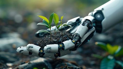
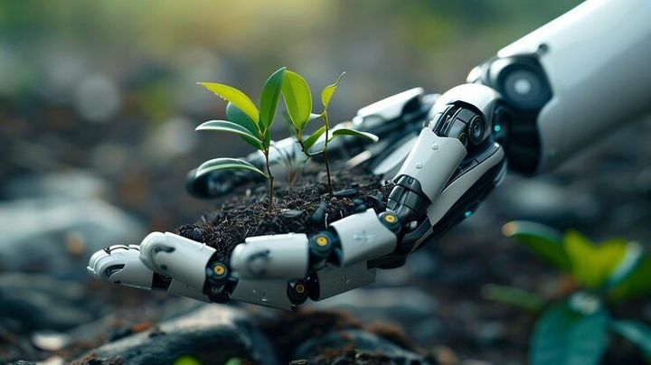
Environmental robotics is the use of robots, sensors, and automated monitoring systems to observe natural environments, collect data, and support environmental protection. These technologies help researchers study forests, rivers, oceans, agricultural land, air quality, and areas affected by pollution. An Environmental Robotics Guide explains how these systems work, where they are used, and how they contribute to environmental monitoring and conservation.
Context
Environmental robotics is the use of robots, sensors, and automated monitoring systems to observe natural environments, collect data, and support environmental protection. These technologies help researchers study forests, rivers, oceans, agricultural land, air quality, and areas affected by pollution. An Environmental Robotics Guide explains how these systems work, where they are used, and how they contribute to environmental monitoring and conservation.
Environmental robotics developed through advances in robotics, remote sensing, electronics, satellite navigation, and computer processing. Early environmental research often depended on human observation, physical sampling, and laboratory analysis. Although these methods remain important, robotic systems can collect measurements from locations that are difficult, dangerous, or time-consuming for people to access.
Today, environmental robots include aerial drones, underwater vehicles, ground-based robots, and stationary monitoring units. Their equipment may include cameras, temperature sensors, air-quality detectors, water-quality probes, and instruments that measure gases or other environmental conditions. Data from these devices can help scientists identify changes, examine pollution patterns, and understand how ecosystems respond to human activities and natural events.
Main Types of Environmental Robots
Environmental robots are designed according to the conditions they must observe and the tasks they perform. Their mobility, operating time, sensor capacity, and communication methods differ.
Aerial drones: Uncrewed aircraft equipped with cameras or environmental sensors. They can survey forests, wetlands, coastlines, agricultural areas, and damaged landscapes.
Underwater robots: Remotely operated vehicles and autonomous underwater vehicles used to examine marine habitats, inspect submerged structures, and collect oceanographic measurements.
Ground robots: Mobile platforms that travel across soil, vegetation, or rough terrain to collect samples, inspect habitats, and measure local environmental conditions.
Stationary monitoring robots: Fixed or semi-fixed systems that continuously record measurements such as temperature, particulate matter, water levels, or gas concentrations.
Robotic sampling systems: Automated equipment that collects water, soil, sediment, or other samples for later laboratory examination.
Some systems operate independently for a planned period, while others require continuous human supervision. Their suitability depends on environmental conditions, mission objectives, and the reliability of their equipment.
Sensors and Environmental Monitoring Systems
Sensors are essential components of environmental robotics because they convert physical or chemical conditions into measurable information. A robot may carry several sensors to examine different aspects of the same location.
For example, an aerial drone can capture images of vegetation while measuring selected atmospheric conditions. An underwater robot may combine cameras, depth instruments, and water-quality sensors to study aquatic habitats.
Environmental monitoring systems usually include three connected elements: data collection, data transmission or storage, and data analysis. Depending on the design, information may be transmitted wirelessly, stored onboard, or processed directly by the equipment.
Importance
Environmental robotics matters because environmental conditions can change across large areas and over short periods. Pollution events, forest fires, coastal erosion, flooding, habitat disturbance, and changes in water quality may require repeated observations to understand their causes and effects. Robots can help collect information from locations where direct human access is difficult or where repeated measurements are necessary.
These technologies are relevant to environmental scientists, agricultural researchers, conservation organizations, public authorities, industrial facilities, and communities affected by environmental hazards. Their measurements can support planning and investigation, although decisions still require suitable evidence, interpretation, and oversight.
Environmental Problems Addressed by Robotics
Environmental robots support several types of monitoring and investigation.
Air pollution: Mobile and stationary systems can measure selected pollutants or particulate matter, depending on their sensor configuration.
Water contamination: Water-quality probes can record characteristics such as temperature, pH, dissolved oxygen, conductivity, and turbidity.
Forest monitoring: Drones can document vegetation patterns, identify visible damage, and help map areas affected by fires.
Wildlife and habitat research: Cameras and remote platforms can observe habitats while reducing the need for frequent human presence.
Agricultural monitoring: Robotic platforms can assess soil conditions, vegetation health, irrigation patterns, and selected crop characteristics.
Disaster assessment: Robots can enter hazardous or inaccessible locations to gather information after floods, fires, chemical incidents, or other emergencies.
Robotic monitoring does not automatically prevent environmental damage. Its contribution depends on whether collected information is accurate, interpreted correctly, and used in an appropriate response.
Comparing Environmental Robotics Technologies
| Technology | Main function | Typical environmental use |
|---|---|---|
| Aerial drone | Surveying and imaging | Forest mapping and habitat assessment |
| Underwater vehicle | Submerged observation | Marine research and waterway inspection |
| Ground robot | Mobile measurement and sampling | Soil studies and hazardous-area investigation |
| Fixed sensor station | Continuous measurement | Air and water monitoring |
| Satellite remote sensing | Large-area observation | Land-cover and vegetation analysis |
| Automated sampling unit | Collecting physical samples | Water and soil analysis |
Satellites are not robots in the conventional mobile-machine sense, but their remote-sensing data can complement robotic monitoring systems. Combining several technologies may provide a more complete understanding of an environmental problem than relying on a single instrument.
Benefits and Limitations
Robotic systems can increase the frequency of observations, improve access to difficult terrain, and reduce the need for people to enter hazardous locations. Automated collection can also help researchers compare conditions over time when instruments are properly calibrated and measurements follow consistent procedures.
However, environmental robotics has limitations. Sensors may drift, equipment can fail, batteries may restrict operating time, and weather can interfere with measurements. Cameras may also struggle in poor visibility, dense vegetation, or murky water. In addition, automated classification systems can misinterpret images or measurements, so validation and human review remain important.
Recent Updates
Environmental robotics is developing alongside advances in artificial intelligence, smaller sensors, battery technology, satellite communication, and autonomous navigation. Current trends include combining multiple data sources, improving automated detection, and coordinating different robotic platforms for environmental research. Adoption varies by region, research budget, operating conditions, and the type of environmental problem being studied.
Artificial Intelligence and Automated Analysis
Artificial intelligence can help environmental researchers examine large collections of images and sensor readings. Image-analysis systems may identify visible vegetation changes, map debris, classify land cover, or detect patterns associated with environmental disturbances.
Machine-learning models can also help identify unusual measurements in air-quality or water-quality records. However, performance depends on the quality of the training data, the environmental setting, and the characteristics of the sensors. Automated findings may require confirmation through field observations or laboratory testing.
Autonomous Navigation and Connected Sensors
Improved navigation technologies allow some robots to follow planned routes, avoid obstacles, and adjust their movements to changing conditions. Autonomous underwater vehicles can survey selected areas, while ground robots can follow routes through research sites. These capabilities still depend on equipment design, communication availability, and operating conditions.
Internet-connected sensors can transmit readings to centralized platforms for storage and analysis. Combining these readings with drone imagery, geographic information systems, and satellite observations can help researchers examine changes at different scales. In remote locations, limited connectivity may require local data storage until communication becomes available.
Environmental Monitoring and Conservation Trends
Recent environmental research increasingly uses repeated measurements rather than relying entirely on isolated surveys. Robotic platforms can support this approach by collecting comparable observations over time. Applications include tracking shoreline changes, assessing vegetation recovery, documenting pollution, and studying habitat conditions.
Researchers are also examining the environmental effects of the technologies themselves. Battery production, electronic waste, equipment maintenance, and disturbance to wildlife are relevant considerations. Responsible deployment therefore includes planning for equipment recovery, safe operation, and appropriate disposal of electronic components.
Laws or Policies
Environmental robotics operates within several areas of law and public policy. Relevant requirements may cover environmental protection, aviation, wildlife conservation, water management, data privacy, workplace safety, and the use of radio equipment. The applicable rules depend on the robot's design, location, activity, and intended purpose.
Environmental Protection Rules in India
In India, the Environment (Protection) Act, 1986, provides a broad legal framework for environmental protection. The Water (Prevention and Control of Pollution) Act, 1974, and the Air (Prevention and Control of Pollution) Act, 1981, address water and air pollution respectively. These laws help establish the wider regulatory context in which environmental monitoring and pollution-control activities take place.
The Central Pollution Control Board and State Pollution Control Boards have responsibilities under applicable environmental laws, including pollution monitoring and regulatory functions. Robotic measurements may support research or monitoring, but their legal acceptance depends on the relevant standards, methods, and regulatory requirements. A sensor reading alone does not necessarily establish regulatory compliance or prove a violation.
Drone Operation and Data Protection
Drone-based environmental surveys in India are subject to applicable aviation requirements, including the Drone Rules, 2021, and subsequent changes where relevant. Operational requirements can depend on the drone category, airspace, location, and type of activity. Restrictions may apply near airports, sensitive facilities, and other controlled areas.
Environmental robots equipped with cameras may capture identifiable people, private property, or sensitive locations. The Digital Personal Data Protection Act, 2023, and associated rules and commencement arrangements form part of India's evolving data-protection framework. Applicable obligations depend on the data collected, the circumstances of processing, and the provisions in force.
Researchers and organizations may also need permissions for work in protected areas, wildlife habitats, restricted sites, or particular waterways. Local authorities and relevant regulatory bodies can clarify requirements for specific activities.
Tools and Resources
Environmental robotics depends on tools for navigation, data collection, mapping, analysis, and documentation. The appropriate combination varies according to the environmental setting and the research question.
Mapping and Data Analysis Platforms
Geographic information systems help organize measurements according to location. QGIS is a geographic information system used to display spatial data, compare map layers, and examine environmental patterns. Satellite imagery and drone photographs can be combined with field measurements when their coordinate systems, resolution, and collection methods are compatible.
Researchers may use Python-based data analysis libraries to clean sensor readings, calculate averages, examine trends, and identify unusual values. Data records should include measurement units, timestamps, instrument details, and calibration information to support accurate interpretation.
Environmental Data Resources
Several established organizations provide environmental information and technical guidance:
Central Pollution Control Board: Indian information relating to air and water pollution, monitoring, and environmental regulation.
India Meteorological Department: Weather observations, forecasts, and meteorological information relevant to field operations.
National Centre for Sustainable Coastal Management: Research and resources relating to coastal and marine environmental management in India.
NASA Earthdata: Earth observation datasets used in environmental and climate research.
United States Environmental Protection Agency: Technical information about environmental monitoring methods, pollutants, and measurement considerations.
These resources serve different purposes, and data availability, geographic coverage, and permitted uses vary. Researchers should check the documentation associated with each dataset before combining it with robotic measurements.
Planning an Environmental Robotics Project
A project generally begins by defining the environmental question, selecting measurable indicators, and identifying the location and conditions of observation. The next steps involve selecting suitable robots and sensors, planning calibration and sampling procedures, arranging permissions, and establishing safe operating practices.
After data collection, researchers assess data quality, document uncertainty, compare results with relevant reference measurements, and communicate findings clearly. This process helps distinguish observed conditions from estimates or automated interpretations.
FAQs
What is environmental robotics used for?
Environmental robotics is used to collect information about air, water, soil, vegetation, wildlife habitats, and other environmental conditions. Applications include pollution monitoring, conservation research, disaster assessment, and agricultural observation.
How do sensors support environmental monitoring systems?
Sensors measure selected physical or chemical properties, such as temperature, pH, particulate matter, humidity, or dissolved oxygen. Their readings help researchers examine environmental conditions and changes over time.
Can environmental robots help reduce pollution?
Robots can help locate pollution, measure affected areas, and collect information for investigation. They do not automatically remove pollution or ensure that corrective action takes place.
What laws affect environmental robotics in India?
Relevant requirements may include environmental protection legislation, pollution-control rules, drone regulations, wildlife protections, and applicable data-protection requirements. The specific rules depend on the activity and location.
What are the main limitations of environmental robots?
Common limitations include sensor errors, battery constraints, communication problems, difficult terrain, weather exposure, and uncertain automated analysis. Calibration, maintenance, and human review help address these challenges.
Conclusion
Environmental robotics combines robots, sensors, and monitoring systems to collect information about natural environments and human impacts. Applications range from air and water quality measurements to forest mapping, marine research, and disaster assessment. Artificial intelligence and connected sensors are expanding analytical capabilities, while technical limitations and regulatory requirements remain important. Reliable environmental monitoring depends on suitable equipment, sound measurement practices, data validation, and responsible use.