Deep Dive into Drone Cameras & Accessories: Expert Insights and Analysis
Drone cameras have revolutionized how we capture, analyze, and experience the world from above. Originally developed for military and surveillance purposes, drone imaging technology has evolved to serve industries such as filmmaking, agriculture, construction, mapping, and environmental monitoring.
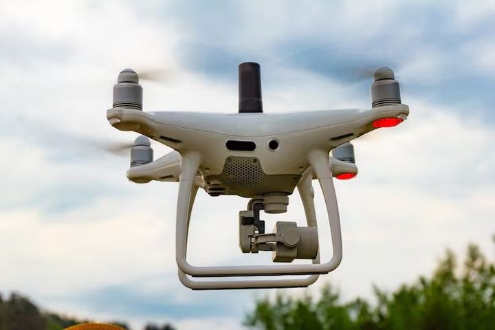
A drone camera is an aerial imaging device mounted on an unmanned aerial vehicle (UAV). Modern drones combine high-resolution sensors, stabilization systems, and smart accessories to capture detailed images and videos from unique perspectives.
Common Types of Drone Cameras
| Type | Features | Applications |
|---|---|---|
| HD & 4K Cameras | High-resolution, smooth video capture | Filmmaking, photography |
| Thermal Cameras | Detect heat signatures | Agriculture, search & rescue |
| Multispectral Cameras | Capture multiple light wavelengths | Crop health analysis |
| LiDAR Systems | Laser-based distance mapping | Construction, topography |
| FPV (First Person View) Cameras | Real-time immersive flight | Drone racing, live streaming |
Accessories such as gimbals, filters, extended batteries, and remote controllers enhance the drone’s capability for stability, endurance, and creative control.
Importance – Why Drone Cameras Matter Today
Drone cameras have become indispensable tools for aerial innovation across multiple sectors. They bridge the gap between ground-based observation and satellite imagery, providing a versatile and affordable way to collect high-quality visual data.
Key Benefits and Uses
-
Aerial Photography & Filmmaking: Enables cinematic shots and panoramic views impossible to capture from the ground.
-
Agriculture & Forestry: Monitors crop health, irrigation, and deforestation using spectral and thermal imaging.
-
Infrastructure Inspection: Inspects bridges, towers, and pipelines safely without human risk.
-
Disaster Response: Assists rescue teams with real-time aerial visuals in floods, fires, and earthquakes.
-
Research & Mapping: Generates accurate 3D models and maps for urban planning and geological studies.
Problem-Solving through Drone Cameras
| Challenge | Drone-Based Solution |
|---|---|
| High inspection risks | Remote aerial monitoring |
| Time-consuming land surveys | Automated mapping and LiDAR scanning |
| Limited visual perspective | 360° aerial imaging |
| Costly film production | Affordable aerial videography |
| Environmental assessment | Data collection through multispectral sensors |
The integration of AI, GPS, and real-time analytics has expanded drone functionality beyond photography, making it a critical tool for data-driven decision-making.
Recent Updates – Trends and Innovations (2024–2025)
Drone technology continues to evolve with advancements in AI-based stabilization, autonomous flight, and modular accessories. The year 2024–2025 marks a significant leap in how drones are designed, operated, and regulated.
Current Trends in Drone Cameras
| Trend | Description | Impact (2024–2025) |
|---|---|---|
| AI-Powered Tracking | Automatically follows subjects with precision. | Enhances creative control for filmmakers and surveyors. |
| Modular Camera Systems | Interchangeable lenses and sensors. | Allows customization for specific industries. |
| 4K and 8K Video Capture | Ultra-HD clarity for media and analytics. | Improves image accuracy in professional use. |
| Thermal + RGB Fusion Cameras | Combines visible and heat data. | Increases accuracy in agriculture and safety inspections. |
| Extended Flight Accessories | High-density batteries and solar charging kits. | Boosts drone endurance for long missions. |
| AI Object Recognition | Real-time obstacle and subject detection. | Reduces accidents and improves navigation. |
Recent Developments
-
In January 2025, drone manufacturers began integrating edge computing for faster image processing directly onboard.
-
Autonomous fleet systems launched in late 2024, allowing multiple drones to coordinate mapping tasks simultaneously.
-
A 2025 breakthrough in lightweight gimbal technology has improved stabilization, especially in windy conditions.
These advancements indicate that drone cameras are becoming smarter, safer, and more specialized for industrial and creative applications alike.
Laws or Policies – Global and Regional Regulations
Because drones operate in shared airspace, they are subject to strict rules and licensing standards. These laws govern drone flight height, privacy, and camera usage to ensure safety and ethical operation.
Major Drone Regulations (2024–2025)
| Region | Authority | Key Regulations | Focus |
|---|---|---|---|
| United States | FAA (Federal Aviation Administration) | Requires drone registration and Remote ID. | Airspace safety and identification. |
| European Union | EASA (European Union Aviation Safety Agency) | Categories for hobbyist, professional, and research use. | Standardized drone operation laws. |
| India | DGCA (Directorate General of Civil Aviation) | Digital Sky platform for drone licensing and flight permission. | Air traffic coordination and accountability. |
| Japan | JCAB (Japan Civil Aviation Bureau) | Drone pilot certification and night operation rules. | Enhanced security and operation control. |
| Australia | CASA (Civil Aviation Safety Authority) | CASA registration for drones above 250g. | Safety and privacy enforcement. |
Policy Highlights
-
India’s Drone Rules 2025 Update introduced simplified licensing for research and agriculture drones under 2 kg.
-
The U.S. FAA Remote ID mandate (effective March 2024) requires drones to broadcast identification for transparency and tracking.
-
The EU Green Aerial Technology Program (2025) promotes eco-friendly drones using low-emission power systems.
These policies balance innovation with air safety, helping drone operators comply while encouraging responsible use.
Tools and Resources – Essential Drone Accessories and Software
A well-equipped drone setup includes a combination of hardware accessories and software tools to enhance performance, stability, and data accuracy.
Must-Have Drone Accessories
| Accessory | Purpose | Use Example |
|---|---|---|
| 3-Axis Gimbal | Stabilizes camera during flight | Smooth video recording |
| ND Filters | Controls light exposure | Filming in bright conditions |
| Extra Battery Packs | Extends flight duration | Long aerial surveys |
| Propeller Guards | Increases safety | Indoor or beginner flights |
| Landing Gear Extensions | Prevents camera damage | Uneven surfaces |
| Data Storage Cards (UHS-II) | Stores large video files | 4K/8K video recording |
| Carrying Cases & Backpacks | Protects drone and accessories | Field mobility |
Software and Analysis Tools
| Software/Platform | Function | Use Case |
|---|---|---|
| DroneDeploy | Cloud mapping and 3D modeling | Construction, agriculture |
| Pix4D | Photogrammetry and data analytics | Mapping and topography |
| DJI Terra | Flight planning and 3D reconstruction | Infrastructure inspection |
| AirMap | Airspace management and flight authorization | Compliance and navigation |
| Adobe Premiere Pro | Video editing and stabilization | Film and content creation |
These accessories and tools ensure higher precision, smoother operations, and professional-quality results across both creative and technical industries.
Example Table: Drone Camera Evolution Over Time
| Year | Key Development | Impact |
|---|---|---|
| 2015 | Introduction of 4K drone cameras | Elevated aerial video standards |
| 2018 | AI-based subject tracking | Smarter cinematography |
| 2021 | Compact foldable drones | Increased accessibility |
| 2023 | Integration of thermal + RGB cameras | Expanded industrial use |
| 2025 | Edge computing onboard drones | Real-time image processing |
FAQs – Common Questions About Drone Cameras and Accessories
1. What makes a good drone camera?
A good drone camera offers high resolution (at least 4K), wide dynamic range, and strong stabilization for smooth aerial imaging.
2. Are drone cameras legal everywhere?
No. Drone usage depends on local aviation laws. Operators must comply with airspace regulations and privacy policies specific to their country.
3. What accessories improve drone photography?
Gimbals, ND filters, and extra batteries are essential for stability, lighting control, and extended shooting time.
4. Can drones be used for professional filmmaking?
Yes. Many professional films and documentaries use drones equipped with 8K cameras for unique cinematic angles.
5. How do thermal drone cameras work?
Thermal cameras detect infrared radiation (heat) emitted by objects, creating images based on temperature differences — useful in rescue, inspection, and environmental work.
Conclusion
Drone cameras and accessories have transformed aerial technology into a practical and creative powerhouse. With their ability to capture high-definition visuals, analyze environmental data, and enhance cinematic storytelling, they continue to push the boundaries of what’s possible from above.
As innovation accelerates through AI, modular accessories, and policy modernization, drones are evolving from hobbyist gadgets into essential instruments across industries. From smart sensors to autonomous fleet systems, the drone ecosystem of 2025 reflects a balance between precision, safety, and innovation — defining the future of visual exploration.